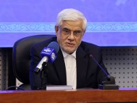
Dr. Mounesan made the comments during a special ceremony for unveiling Geographic Information System (GIS) of Kish Island.
According to the Public Relations and International Affairs Department of Kish Free Zone Organization Dr. Mounesan said that Kish GIS data bank has been set up as part of future plans for developing infrastructures of Kish.
Dr. Mounesan described GIS data bank as a necessity for the development of Kish Island and said the establishment of the data bank will contribute to taking decisions on the basis of accurate urban data.
He said the data bank gives unlimited access to the urban information and is the key to turning Kish into Iran's first virtual city.
Kish GIS has been prepared in three sections including properties, population and trade guilds.
GIS or Geographic Information System is a system designed to capture, store, manipulate, analyze, manage, and present all types of spatial or geographical data.
PR & Int'l Affairs Department- KFZO


